
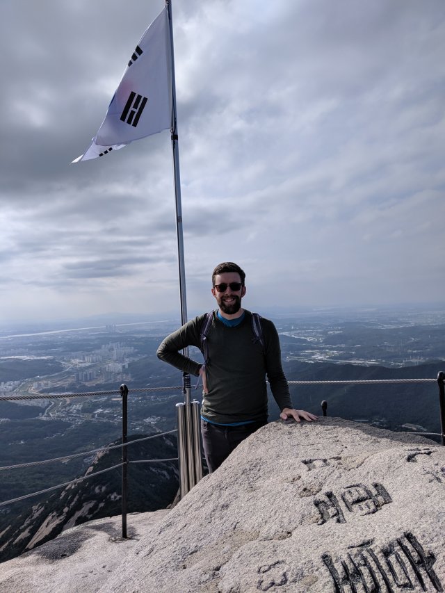
Today I climbed a mountain!
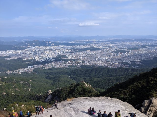
The mountain is called Baegundae in Bukhansan National Park, just north of Seoul. The park is practically in the city – suburbs wrap around 3 sides of it, and there’s a bus that runs directly there from my hostel.
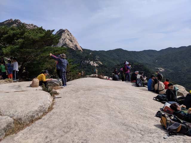
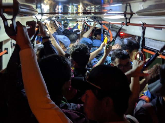
Because of its proximity to one of the biggest cities in the world, Bukhansan has more visitors per square meter than any other national park in the world. Plus I visited on a beautiful warm weekend day right at the end of the summer. So you might say it was a little crowded.
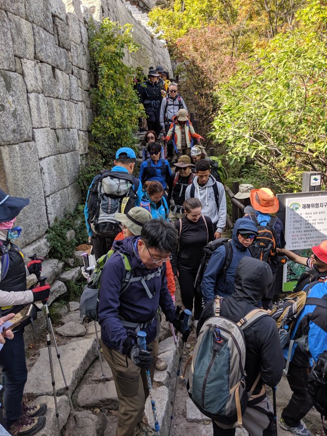
I would compare this hike to Mt. Si in Seattle, both in (theoretical) length and difficulty, and in its phenomenal view from the top. Maybe it’s more crowded, but I haven’t ever been to Si on a sunny weekend.
So how did I get lost on a trail this crowded? It took a perfect storm.
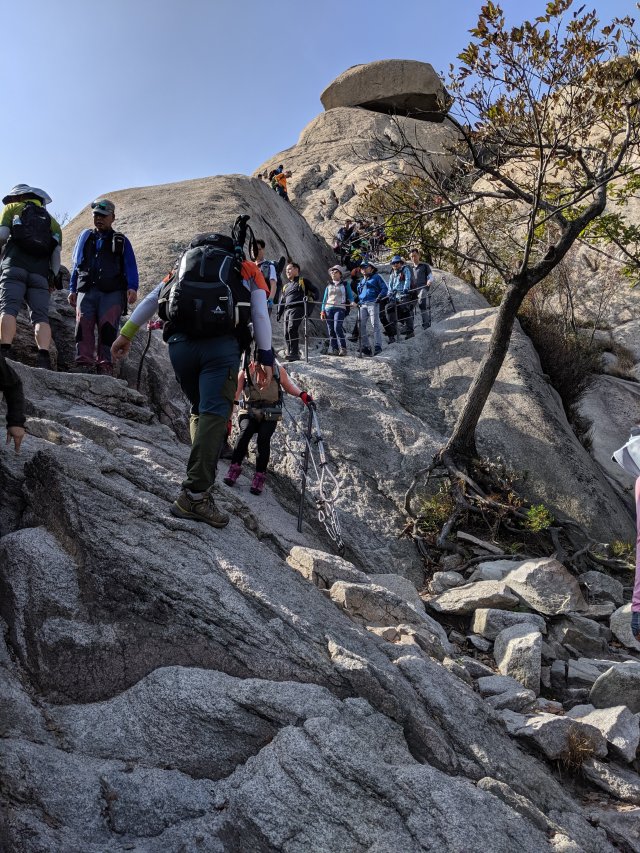
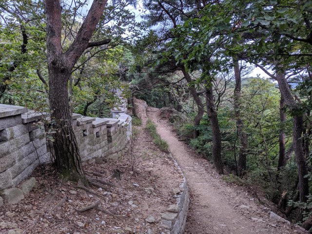
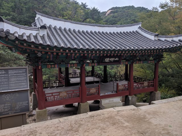
First, there are multiple ways into the park, and many loops and interior destinations. The whole mountain range was originally a fortress / temple complex, and there’s much more to it than just the climbing course. My plan was to take the steep path up and the long but easier path down.
Second, signage was incredibly poor. Direction posts were inconsistent in what they pointed to, and the maps posted at trail junctions showed different landmarks. I started with a solid idea of what I wanted to do, but figuring out how that matched up with the trail on the ground was tricky.
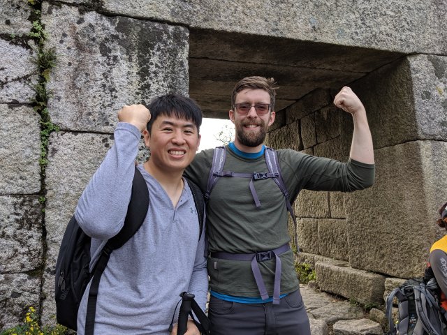
Third, I met a friend. Just after reaching the summit, I ran into Min Koo from the Purdue marching band. I would have walked right past him, but he somehow picked me out from the crowd despite me growing a beard and us not having seen each other in 6 years. We caught up a bit, and then I asked him what was the right way down the mountain, just to double check. What I did not tell him is what entrance I was headed for, and when he told me the opposite of what I thought I was just able to convince myself it made sense.
So, I had myself yet another adventure. I got all the way down to the parking lot on the other side. A wise man would have called it quits and figured out how to bus home, so of course I headed back up into the hills down another path that I was sure would get me to where I started.
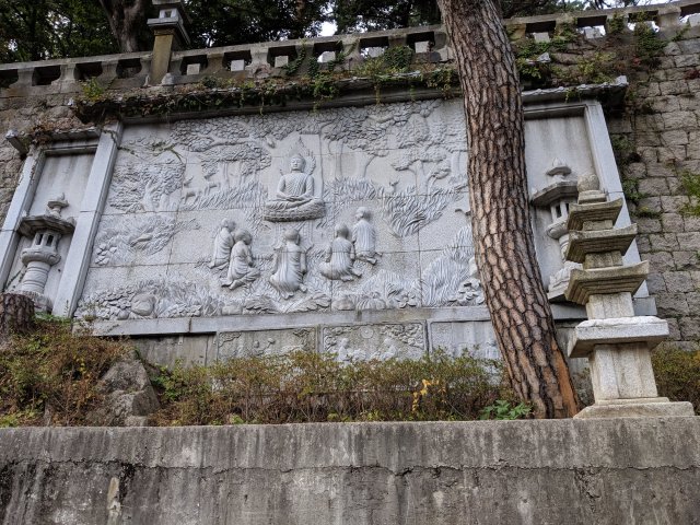
It did, but it took a while. Along the way I stumbled upon an incredible temple up in the hills, along with a park ranger who didn’t speak English, but I’m pretty sure was trying to tell me the sun was going down and I needed to hurry my butt up. I asked him “Bukhansanseung?”, the name of my destination, and he said “ok go fast”.
So I did. I booked it over the lower pass, picked up the trail I intended to take from the start, and made it down just as twilight was setting in. But the crowds weren’t quite finished with me.
Not a bad day all in all, but tiring. Next time I go up I’m going to bring a good map.

I love the alltrails and gaiagps apps for their maps and navigational aids. Alltrails (and I think Gaia) has a free version but you have to pay to download maps for use when off the grid, which is essential. I have both; I generally prefer alltrails’s interface, but gaia has better maps in some places, especially abroad, in my limited experience.
LikeLiked by 1 person
Good advice, I’ll check those out.
LikeLike
I admire you; you’re a bold adventurer.
LikeLike
Looks like Machu Pichu – shoulder to shoulder packed!
LikeLike
Pingback: Wonderland Preparations – Dan Roberts